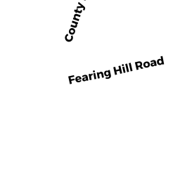
142 FEARING HILL RD
Owner Information
ASHLEY HERBERT W TRUSTEE
142 FEARING HILL RD
W WAREHAM, MA 02576


Property Details
142 FEARING HILL RD is classified as a Mixed Use (Primarily Agriculture) (Garage/office).
The primary structure on this property was built in 1970. There are 1,536ft2 of built area within this property. There is 768ft2 of residential/living space within this property.
142 FEARING HILL RD is valued at $97,100. The land is valued at $25,900 and the structures are valued at $43,100. There is an additional valuation of $28,100 on this property.
This property is in Zone R60. Confirm with local Zoning Board authorities to ensure there are no overlays or other easements on this property.
The most recent deed for 142 FEARING HILL RD is recorded at the local registrar in Book 16194, Page 0160. 142 FEARING HILL RD was last sold on Thursday, May 14, 1998 for $10.
Assessment data from fiscal year 2022.
Flood Data
According to the FEMA National Flood Hazard Layer, this property does not appear to be in a flood zone. It may also be in an area not yet reviewed. Nonetheless, confirm this information prior to taking any action.
To view the flood hazards around this property, create a FEMA "Firmette" Map of the area around 142 FEARING HILL RD.
Broadband Internet Providers
| Provider | Type | Bandwidth (mbps) | |
|---|---|---|---|
| GCI Communication Corp. | Satellite | 0 | 0 |
| Verizon New England Inc. | Fiber | 940 | 880 |
| Verizon New England Inc. | DSL | 5 | 0 |
| Viasat Inc | Satellite | 35 | 3 |
| VSAT Systems, LLC. | Satellite | 2 | 1 |
| HughesNet | Satellite | 25 | 3 |
| Comcast | Cable | 1000 | 35 |
Broadband service provider data from December 2020.
Adjacent Properties
- 0 SQUIRREL IS RD
Mass. Highway Dept. (MHD) (non-reimbursable) owned by COMM OF MASS - 23 HARVEST CIR
Single Family Residential owned by REID PAUL - 29 HARVEST CIR
Single Family Residential owned by BOUCHER CHRISTINE L - 33 HARVEST CIR
Single Family Residential owned by FARIAS ERIC - 0 TERRY LN
Improved, Selectmen or City Council (Municipal) owned by TOWN OF WAREHAM - 0 FONSECA WY
Undevelopable Residential Land owned by CORNERSTONE ESTATES 2 - 19 HARVEST CIR
Single Family Residential owned by COHN PETER C - 15 R HARVEST CIR
Undevelopable Residential Land owned by ASHLEY HERBERT W TRUSTEE - 142 FEARING HILL RD
Mixed Use (Primarily Residential, some Commercial) owned by ASHLEY HERBERT W TRUSTEE - 138 FEARING HILL RD
Single Family Residential owned by HALUNEN CHESTER - 134 FEARING HILL RD
Undevelopable Residential Land owned by HALUNEN CHESTER - 130 FEARING HILL RD
Undevelopable Residential Land owned by ASHLEY HERBERT W TRUSTEE - 0 FEARING HILL RD
Mass. Highway Dept. (MHD) (non-reimbursable) owned by COMM OF MASS